< Previous | List | Next > Driving west, out of Idaho and into Oregon
Click to enlarge!
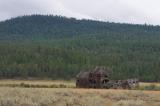
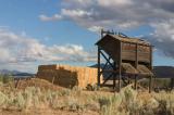
The remains of a sawmill constructed by Nibley Lumber Company in 1911.
Wallowa-Whitman National Forest (Whitney)
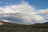
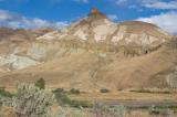
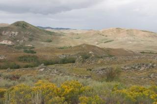
John Day Fossil Beds National Monument (Mascall Formation Overlook)
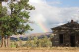
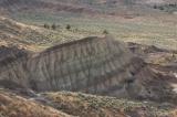
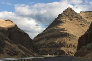
John Day Fossil Beds National Monument (Sheep Rock Unit)
John Day Fossil Beds National Monument (Sheep Rock Unit)
I was on the road again before 8am. There was a dense cloudcover at Craters of the Moon, and as such I headed on without looking back (or taking any pictures, for that matter).
On a whim, and without having done any reading up on it, I decided to head into Sawtooth National Forest. Unfortunately, after driving up into the mountains without seeing much mountain scenery due to prevailing cloud cover, my "I'll fuel up at the next opportunity" attitude caught up with me, and I found myself with a gas tank that was nearing empty, and no way to know where I'd find the next open gas station on the road ahead of me.
After weighing off the alternatives, I turned around and headed back into civilisation. In the first major town, I fueled up and got breakfast.
 Considering the weather hadn't changed, I didn't feel like driving up the same road again, and as such I decided to head west, out of Idaho. This took me across more fairly barren farmland on Highway 20, then across more desert areas, and then after a burger lunch in Boise, ID, I ended up at the state border.
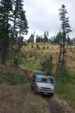
More desert scenery and rain awaited me as I crossed into Oregon. I opted to take smaller roads from here on, and drove into the Wallowa-Whitman National Forest. I briefly stopped in Whitney, a small lumbering town turned ghost town.
Driving lots of miles this day meant that pretty soon, I found myself with a gas tank that was nearing zero, again. Not knowing how much gas my tank actually holds, and how much safety margin there is between the "empty" indicator and the gas tank actually being empty really turned into a major annoyance - I probably agonized over this when I wouldn't have needed to. [As a reference, at home I usually fuel up with anything between a gallon, and half a gallon of fuel left in my gas tank.]
More driving - there sure was a lot of it that day - brought me to John Day Fossil Beds NM, where the sky was still largely overcast. This meant I had pretty bad light at Mascall Formation Overlook; but I was surprised when I looked back and not just saw a very imposing rain cloud, but also some blue sky and a rainbow.
 I drove on some more, and finally had better light at the Sheep Rock Unit of the National Monument. There was still a bit of rain, and unfortunately I was running out of daylight.
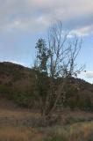
It was time to find a camping spot for the night. On the map, I could see that Ochoco National Forest was nearby, and I decided to tempt my luck at finding a good free "dispersed camping" spot. On the way to the national forest, I passed another shoe tree, but this one wasn't as big or as covered in shoes as the one along US-50 in Nevada.
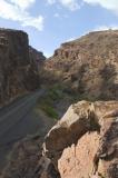
After a few more miles, I left the main highway and took a small paved one-lane road that took me into the national forest. At some point, a pickup came downhill, and the passenger(s) screamed something in my general direction as they drove past, never lifting their foot off the gas pedal. I headed on, slightly concerned about some wacko knowing that I'd probably camp in the woods up that road, but that feeling didn't linger.
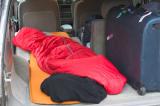
I found a nice spot just off the road, backed into it; and pretty soon lay down for another good night's sleep.
Miles driven: 549mi (884km)
![]() Accommodation: Dispersed camping on Natl' Forest Develop Road 30 (Ochoco National Forest, Wheeler County, Oregon): $0
Accommodation: Dispersed camping on Natl' Forest Develop Road 30 (Ochoco National Forest, Wheeler County, Oregon): $0