< Previous | List | Next > Crossing the Sierra Nevada via Yosemite's Highway 120
Click to enlarge!
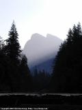
Yosemite National Park
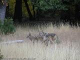
Yosemite National Park (Wolves)
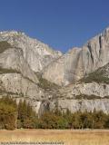
Yosemite National Park
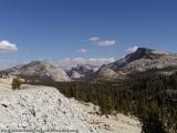
Yosemite National Park (Olmsted Point)
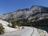
Yosemite National Park (Tenaya Lake)
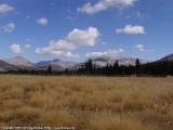
Yosemite National Park (Tuolumne Meadows)
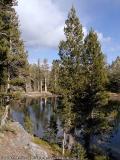
Inyo National Forest (Nunatak Nature Trail)
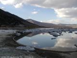
Mono Basin National Forest Scenic Area
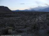
Mono Basin National Forest Scenic Area
After first waking up at 2am, I got up for good around at 5:30am today. The first half hour was spent writing yesterday's trip report and uploading the few pictures that I took. I then took a nice, relaxing bath and then made good use of the free breakfast included in the price of my stay at the Best Western.
By 7:30am, I was finally on the road... but not for long. I obviously needed some water and some snacks to last me through the day. So after less than a mile, I stopped at a gas station with adjacent store, paid $10.83, and was on my way towards Yosemite National Park.
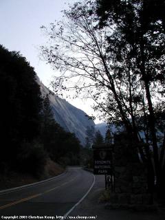 Yosemite National Park Entrance sign near Highway 140
The drive started off fairly misty. I ascended my first pass for the day (Name?), and then followed Bear Creek for a while. An hour after leaving the motel, I passed the El Portal entrance to Yosemite National Park. The decision on whether to get a simple Yosemite entrance at 20$, or pay for a National Park Pass (50$) was a no-brainer - I opted for the later since I plan to visit at least one or two more parks this week, and I'm sure I'll be back here within 12 months...
Rather than immediately driving East on Highway 120 towards Tioga Pass, like I had planned, I chose instead to do a detour via Yosemite Valley. One of the first stops was near Bridalveil Falls, one of the smaller waterfalls in Yosemite, but still holding water (as opposed to the seasonally dry Yosemite Falls). Still, this wasn't a good photo opportunity: the sky was still very white from morning fog, and the sun rising just above the falls didn't help much. So instead, on instinct, I headed into the woods on the left side of the road and almost ran into a small pack of wolves. There were four of them, and they weren't overly shy, just doing a slow retreat as they became aware of my presence, me using the 380mm zoom of my camera to the max.
Next, I stopped near El Capitan, and again ventured away from the road, this time towards Merced River, to take some pictures of water reflections. Unfortunately, 38mm isn't wide enough, and that's all my camera can handle, so I'm stuck with pictures that either show El Capitan, or its reflection, but never the two of them in their completeness at the same time. Too bad.
Just like last year in July, the Lower and Upper Yosemite Falls were completely dry. So no photo opportunity there.
As I approached Yosemite Village, the crowds grew larger, and I decided to escape towards more solitude on Highway 120.
The first part of the drive up Highway 120 was spectacular, and it wasn't. There was controlled fire-burning, so driving through the forest with smoke and the smell of burning wood all around was a spectacular experience. Not being able to see much, the smoke ruining most photo opportunities, and the smell of burning wood not being all that pleasant, made it less spectacular.
Around Siesta Lake, the smoke finally cleared, and I got out of the car for a quick stroll to this dying pond.
Shortly after this stop, having gone up to around 8000 feet, I was finally in the high Sierra, with more panoramic vistas all around. One of these, Olmsted Point, was already a stopping point last year, and this year wasn't any different. Unfortunately, the view of Half Dome was lessened by smoke, again.
Hike around Tenaya Lake
- Trip Odometer: 2.99mi;
- Trip Time: 01:15;
- Starting elevation: 8160ft;
- Average speed: 2.3 mi/h;
- Total Ascent: 464ft,
- Total descent: 375ft;
- Min Elevation: 8150ft;
- Max Elevation: 8237ft
Already visible from Olmsted Point, Tenaya Lake was to be my next stop, and the start of a short hike. Walking through the forest on two sides of the lake, along the shore on its third, and finally returning next to the Highway was a nice three mile distraction from driving.
Shortly after this, I finally reached Tuolumne Meadows. Situated at around 9000 feet, the weather was remarkably nice, with just little wind and the sun only sometimes blocked by a few dispersed clouds.
Nevertheless, I headed eastward, towards Tioga Pass, and the Eastern Sierra. Shortly after the pass, I briefly stopped at Tioga Lake, and then took the "Nunatak" Nature Trail, which afforded a few more photographic opportunities.
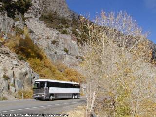 Heading down Lee Vining Canyon while a bus is going up towards Yosemite
After this, it was all downhill. (Literally speaking, of course.) Lee Vining Canyon, to be exact, and dropping a few thousand feet before joining Highway 395.
I reached Mono Lake after the sun had already set behind the mountains, and as such the only thing left for me to do was find a suitable camping spot. After inquiring at the Mono Lake Visitor Center, I chose a random place at the end of a dirt road a few miles from the Southern shores of the lake.
![]() Accommodation: Dispersed camping near Mono Lake (Mono Basin National Forest Scenic Area): $0
Accommodation: Dispersed camping near Mono Lake (Mono Basin National Forest Scenic Area): $0
First part written in my rental car between 6:30pm and 7pm on October 26th 2002 at some dead-end dirt road near Mono Lake (dispersed camping). Second part written at SFO's gate A-9 on November 2nd 2002, with still over one hour left until boarding.